The waiting is the hardest part!
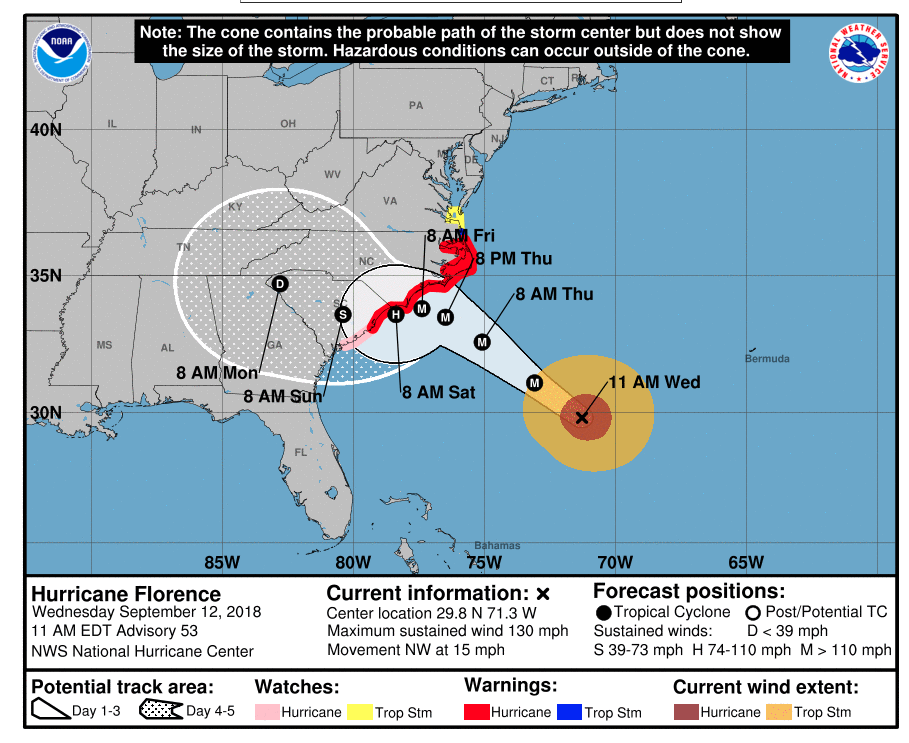
Although a hurricane warning has been issued for the entire North Carolina coast, track guidance for Florence is consistently showing the monster hurricane making landfall well to the south of the Outer Banks, so OBXers wait to see what will happen next. Rob Morris writing for the Outer Banks Voice has the details.
Storm track migrating south, but potential hazards here remain
With evacuations all but complete and the Outer Banks virtually shut down, we wait.
Forecasts for Hurricane Florence keep shifting as the Category 4 storm shakes off predictions on its future strength and destination.
The latest update from the National Hurricane Center shows the storm curving south before crossing onto land at the border of the Carolinas.
By then, the Hurricane Center says, maximum sustained winds might be around 100 mph as Florence scrapes the coast, then heads inland by the weekend.
Today’s forecast is a significant change from previous outlooks, which warned that a major hurricane with top winds of at least 111 mph could cross onto land as far north as Cape Fear, 175 miles from Cape Hatteras.
But if Florence sticks to its reputation, more changes are ahead.

Coastal hazards remain, and inland threats are worrisome. Storm surge and wind are likely to push shallow sound waters into the mainland and up rivers as far west as Greenville. Risks of flooding are also high in Elizabeth City, Edenton and other inland towns.
“Life-threatening, catastrophic flash flooding and significant river flooding is likely over portions of the Carolinas and Mid-Atlantic states from late this week into early next week, as Florence is expected to slow down as it approaches the coast and moves inland,” the Hurricane Center wrote in its 5 a.m. update.
Evacuation orders are still in place for Dare, Currituck and Hyde counties. Dare residents and property owners will be permitted to come and go until 7 p.m., when authorities will start enforcing restrictions to access.
This morning, Hurricane Florence was about 530 miles southeast of Cape Fear and moving west-northwest at 17 mph. Maximum sustained winds were 130 mph.
Hurricane and storm surge warnings are in place up to Duck. Watches extend into Virginia.
The latest forecast from the National Weather Service office in Newport-Morehead City calls for 6 to 10 inches of rain and wind gusts over 50 mph in northeastern North Carolina this weekend.
Warnings about the risks of staying on the coast left most houses and condos on the oceanfront vacant. The beach road was deserted despite sunshine and warm weather. Government offices, schools and most businesses are closed. Activities and events through the weekend have been cancelled or postponed.
“Regardless of the exact track and intensity, it is clear that Dare County is going to feel the effects of a major hurricane,” Dare County Emergency Management Director Drew Pearson said earlier this week.
“Take precautions now and assemble or restock your disaster supply kit with essentials to sustain your family and your pets for three to five days. Have your evacuation plan ready to execute.”
Clouds, rain and steady breezes will probably start arriving here on Wednesday with landfall by the weekend. Surge, which is the water a storm pushes ahead of it, would arrive shortly before that.
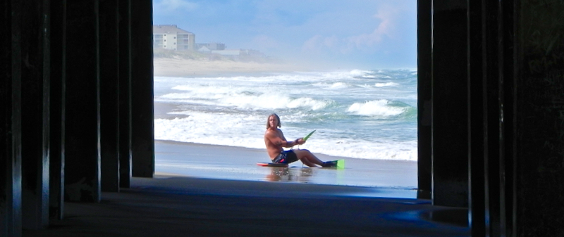
Some overwash has already been reported as swells from the distant storm roll onto the beaches, coupled with an onshore wind and high lunar tides.
Red no-swimming flags have been posted on all beaches.

