Hurricane force winds forecast to remain to south of OBX.
The first squall lines have hit the Outer Bank and the winds are picking up, but the worst of Florence is forecast to remain well to the south. Rob Morris reporting for the Outer Banks Voice has the story.
Hurricane gusts possible; surf will reach 15 to 25 feet today
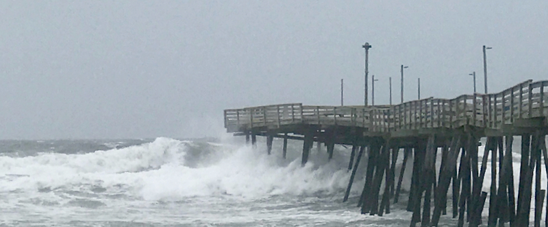
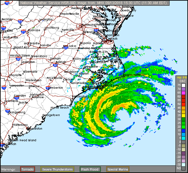
About 150 miles off the coast this morning, Hurricane Florence is forecast to spin off peak winds of 45 to 60 mph on the Outer Banks and surf in the range of 15 to 25 feet.
Gusts could approach hurricane strength of 74 mph.

At 11 a.m. this morning, the National Hurricane Center reported that the storm was 145 miles east-southeast of Wilmington, N.C. and heading northwest at 10 mph, much slower than on Wednesday.
Maximum sustained winds were 105 mph, which will remain far south of the Outer Banks.
Forecasters say the slower forward speed will mean heavy downpours starting later today and continuing through at least Friday night. On the northern beaches, 4 to 6 inches are expected with up to a foot possible on Hatteras and Ocracoke islands.
Storm surge flooding of 3 feet above ground is also forecast through Sunday, which combined with the high surf will probably mean flooded roads.
The surge will also affect inland towns along rivers and streams inland. The surges will last through numerous tide cycles.
Florence is about 400 miles wide, with tropical storm force winds of at least 34 mph radiating 195 miles from the center and hurricane winds of 74 mph or more, 80 miles.