
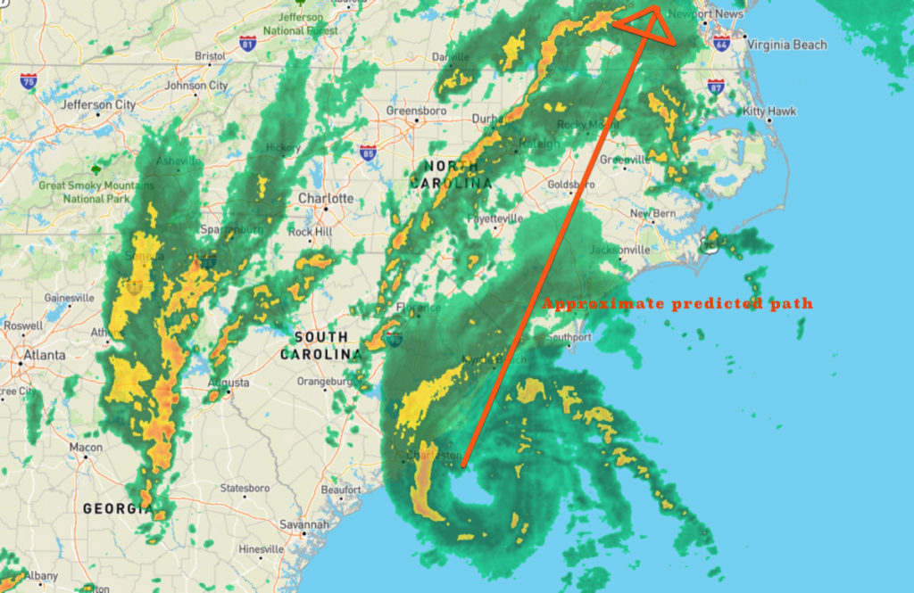
This snapshot taken from the Weather Underground Wundermap radar information at 5:30 shows a number tropical storm characteristics. The arrow indicating the approximate storm track for Tropical Storm Isaias was inserted by us.
The eye of the storm is remarkably well-defined. On the lower right side is an easily seen squall line. As the storm approaches, those are the squalls that will bring rain and wind to the Outer Banks.
A quick check of the weather forecast for Goldsboro and Greenville leave little doubt about the predicted path of the storm. Both cities are forecast to experience winds up to 50 mph with a little bit more than 3” of rain.
The forecast for the Outer Banks calls for winds around 35 mph with much less than 1” of rain.
However, we may be dealing with some soundside flooding as the winds push the waters of the sounds into the bays and creeds on the western side of the Outer Banks.
Interestingly this map also shows a storm cell to the west of the storm. That’s to the left of Isaias. The storms are part of a much larger system that the National Hurricane Center specifically calls out as the dominant steering pattern for the tropical system.
“The new NHC model guidance remains in excellent agreement on Isaias continuing to gradually accelerate north-northeastward to northeastward for the next 36 hours ahead of a powerful deep-layer trough and associated cold front,” the 5:00 p.m. discussion noted.
Content provided by Kip Tabb.