For decades the Outer Banks was viewed as ground zero for catastrophic flood risk, but new mapping technology and research tell a very different story. This article from WUNC’s Eric Mennel does a great job of explaining what is happening and why.
Credit NC Department of Public Safety
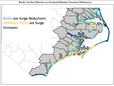
“There is a significant number of properties coming out of the flood zone on the coast,” said John Dorman, director of the state’s flood mapping division, in the Department of Public Safety.
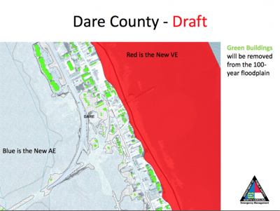
In a presentation prepared by officials at the floodplain mapping program, preliminary maps show the majority of coastal counties having a net decrease in properties in the two flood hazard zones; The VE and AE zones.”
[box type=”bio”] To read the complete article, click HERE.[/box]