The Lost Colony is one of our most popular local legends, and this article in Britain’s Daily Mail confirms it still holds global interest. They report that new evidence may provide an important clue concerning the fate of the disappeared colonists.
“New radar images have shown that British colonists may have settled in a remote part of what is now North Carolina more than 400 years ago – potentially solving a centuries-old mystery.
It was never fully known where a group of 120 settlers from England ended up after they left Europe and headed to the ‘New World’. Historians have debated the fate of the so-called ‘Lost Colony’ for years – having been left with no more evidence than the word ‘Croatoan’ carved into a tree near the abandoned settlement.
Researchers may have now taken a large step towards settling the debate after enlisting the help of magnetometers and ground-penetrating radar (GPR).
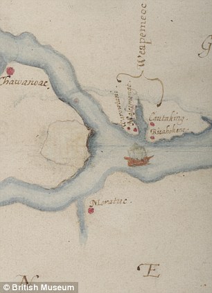
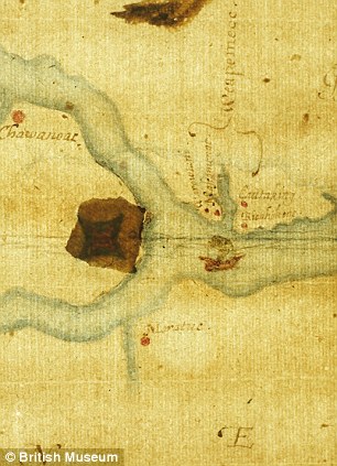
And, in the stuff of a schoolboy’s dreams, the researchers have backed up the glittering technology’s findings with ‘secret’ evidence from a 400-year-old map drawn by one of the settlement’s founders.”
[box type=”bio”] Read the rest of the story HERE.[/box]