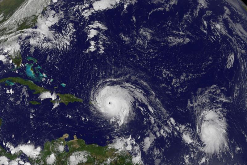
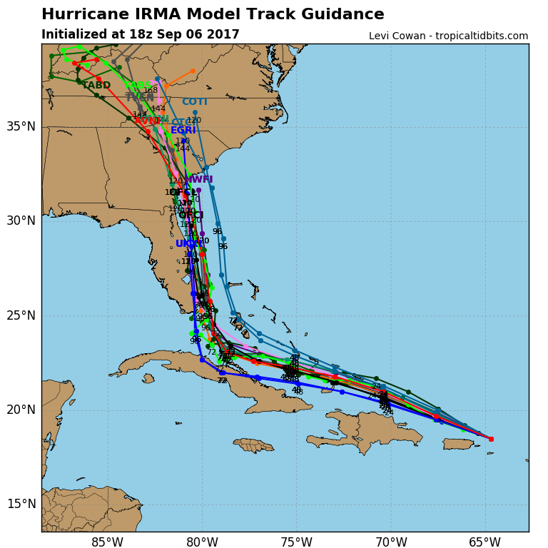
As Hurricane Irma, the most powerful hurricane ever recorded in the Atlantic Basin, makes its way to the US mainland, concerns about its track heighten. Yesterday’s guidance had Irma making landfall on the Georgia/South Carolina state line and then making a beeline for the interior of North Carolina. Rob Morris, writing for the Outer Banks Voice gives some detail.
“Still pumping out 185 mph maximum sustained winds as it crosses the Caribbean, Hurricane Irma is now on a track that leaves big questions about how it will affect the Southeastern U.S. next week.
The National Hurricane Center still projects a landfall in south Florida, but computer mapping after that tends to take the storm up the state’s east coast.
Beyond that, scenarios vary from another landfall in South Carolina to a gradual curve out to sea, with the Outer Banks in between.
In any case, the National Weather Service office in Newport/Morehead City, N.C., said Tuesday that the coast should at least expect swells and rip currents from the storm.”
[box type=”bio”] Read the rest of this story on the Outer Banks Voice .[/box]