Is the Outer Banks in Matthew’s path?
We know we’re going to feel the effects of Hurricane Matthew here on the Outer Banks. What we do not know yet, is what those effects will be. Rob Morris in his article for the Outer Banks Voice does a great job of describing what the Outer Banks is like as it waits.
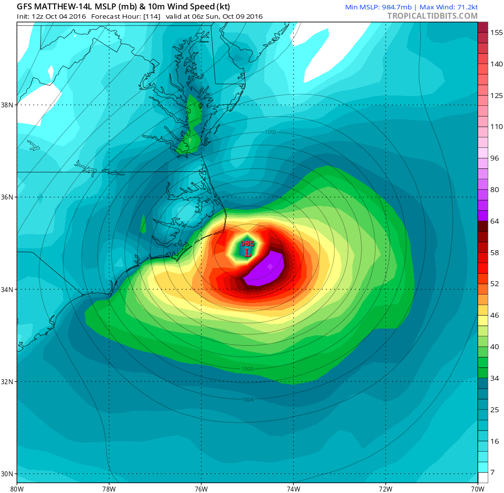
Mixed in with some concerning model runs showing Matthew passing overhead, is the forecast that by the time it gets here, the storm will be moving fast and should not be around long at all. There has also been a shift to the south and out to sea in some forecasting model–the GFS in particular has shifted the eye passing south of Ocracoke. Still too early to tell, though
Stay tuned!
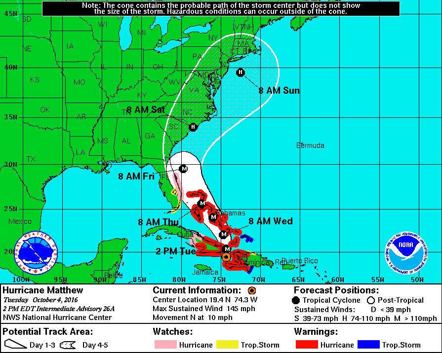
“Computer models have taken unsettling shifts to the west, placing Hurricane Matthew on a path that hugs the Southeast coast from Florida to North Carolina.
Most of the simulations send the storm as a Category 2 hurricane very close to the Cape Fear area, then curving northeast just west of or over the Outer Banks.
How strong the storm will be by that time partly depends on its interaction with land as it scours the coast with heavy rain and wind.”
[box type=”bio”] Please read the rest of this story on the Outer Banks Voice.[/box]