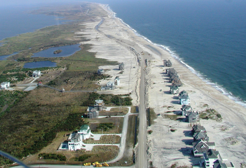
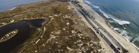
One of the most dynamic stretches of shoreline on the East Coast is the north end of Rodanthe at Mirlo Beach and going north about two miles: the S Curves as it is known locally. The same forces that create world-class waves for surfers also have washed out NC 12 during Hurricanes Isabel, Irene and Sandy. Long-term NCDOT plans are to bridge the area. In the short term, though, other solutions are needed and Bruce Siceloff, writing for the Raleigh News & Observer, explores beach nourishment as a solution.
“Federal park and wildlife officials usually are cool to the idea of scooping up sand to rebuild eroded beaches along the Dare County Outer Banks, but they warmed up last year after Gov. Pat McCrory said it was an emergency.
The state Department of Transportation plans a beach nourishment project this summer to shore up a perennially washed-out section of N.C. 12 at the Hatteras Island village of Rodanthe, after winning cautious approval from the National Park Service and U.S. Fish and Wildlife Service.
The S-Curves stretch of the highway is narrowly shielded from high tide by giant sandbags and artificial dunes, which are continually being repaired and reshaped by big yellow bulldozers.”
[box type=”bio”] To read the complete story, click HERE.[/box]